 |
|
|
COMMITTEE WORKING GROUP | DR. ERNEST MARTIN, CHAIR
Urban Infill & Greenway Minutes 2015
|
- January 21, 2015
- Feb. 11, 2015
- April 20, 2015
- May 18, 2015
- June 23, 2015
- Sept. 23, 2015
- November 18, 2015
- December, 17, 2015
Miami River Commission’s
Urban Infill & Greenways Subcommittee’s Combined Minutes
I. Review Proposed “One Brickell” Mixed-Use Development located at 444 Brickell and 77 SE 5 ST, bordered by the Miami River on the north, Brickell Bridge on the east, SE 5 ST on the south and “Brickell on the River” development on the west:
Ms. Lucia Dougherty and Carlos Lago, Greenberg Traurig, Mr. Rosso, Related Group, Mr Alfonso Jurado and Ms Princess Moquette, Arquitectonica, provided and presented the proposed 3rd draft “One Brickell” (“Miami River Commission submittal set 1/21/15”) Mixed-Use development plans. The Transportation Analysis was provided as well.
The development team distributed and presented Plans for “One Brickell”, 444 Brickell Avenue & 77 SE 5 ST. The plans include the following three buildings developed in the following 2 construction Phases:
Phase I
1. 75-story building parallel “Brickell on the River”, 480 “owned” residential units
2. 55-story building facing SE 5 ST, 500 “rental” residential units
Riverfront Restaurant (1 of 2)
Entire proposed public Riverwalk, connecting at grade to “Brickell on the River’s” existing public riverwalk on the west, and including beneath Brickell Bridge connecting at grade to existing public riverwalk at Miami Circle Park, plus 2 side yard connectors on the east and west and east, connecting the public riverwalk to the public sidewalk (Federal Grant funded planned on-road Miami River Greenway) on SE 5 ST
Phase II
3. 80-story building facing Brickell Ave, 420 residential units plus 249 room Hotel
Riverfront Restaurant (1 of 2)
Total = 1,400 residential units, plus 249 hotel rooms
The development team stated the proposal seeks to purchase an additional 868,399 square feet of density above 48 stories and beyond the sites current high density zoning and were considering the following options to do so:
1) Pay the City of Miami $17.82 per square foot, which would equate to $15,474,870, into the “Public Benefits” Program, or construct Public Benefits valued at the same amount.
2) Provide Affordable Housing
3) Donate Park and Land or improvements
4) LEED Gold = 3%, Platinum = 12%
5) Purchase unused development rights on a historic site from private sector
MRC subcommittee Chairs Murley, Martin and Bibeau noted a major consideration in the MRC’s advisory recommendation to support the recent “Miami River” SAP was the developer constructing $22 million of “Public Benefits” (including $5.2 million in transportation project line items), and noted the importance of using the first option, $15.4 million in public benefits expended in the impacted Miami River District, primarily on mobility and transportation projects, including extending the public Riverwalk off of the subject site. Attendees noted the project is adjacent to the Brickell Bridge, and the MRC has a list of unfunded transportation projects which would improve traffic during temporary regulated Bridge openings, including re-use of a recently removed vehicular travel lane on Brickell Bridge, smart signage warning motorists of bridge openings and providing alternate routes, SE 9 ST cut through beneath Metro-Rail in order to access alternate routes, etc. Director Bibeau stated creating $15.4 million of public benefits in the impacted area is a win-win for the impacted Miami River District, and marketability of the project, being able to note $15.4 million of area improvements will be constructed on needed mobility and transportation improvements in the impacted area, including but not limited to the public riverwalk. Mr Rosso, Related Group, and Ms Dougherty stated they would partner with the MRC, City and County in a mutual effort to count the cost of transportation improvements, including but not limited to including re-use of a recently removed vehicular travel lane on Brickell Bridge, smart signage warning motorists of bridge openings and providing alternate routes, SE 9 ST cut through beneath Metro-Rail in order to access alternate routes, etc., to be funded by the proposed “One Brickell” transportation impact fees and or Public Benefits program.
The structures are all “fully lined” with habitable spaces. Mr Rosso and Ms Dougherty stated the western parcel currently has an active Marine Operating Permit and State Submerged Land Lease for 6 vessels, which they will maintain, and seek a Marine Operating Permit and State Submerged Land Lease for the eastern parcel as well, including Waterborne Transportation / Water Taxi stop.
The development team stated the proposal features a 50-foot waterfront building setback and public riverwalk, consistent with the public riverwalk requirements contained in the City of Miami Zoning Code “3.11”, Appendix B and the City Charter section (mm) (ii) regarding the 50 foot waterfront building setback. In addition, the plans feature a proposed public riverwalk connection to be constructed by the developers beneath Brickell Bridge’s south shore, in order for the proposed “1 Brickell” public Riverwalk to continue east at grade and connect with the existing public riverwalk at the Miami Circle Park, as well as connect to the west at grade with existing public riverwalk at “Brickell on the River”. MRC Greenways Chairman Martin and MRC Director Bibeau noted this 3rd draft set of plans still has obstructions such as trees, lights and staircase made in the public riverwalk’s unobstructed 16 foot wide “circulation zone”.
Ms Dougherty stated the proposed mixed-use development will use its existing zoning and land use. Ms Dougherty noted the project is seeking a reduction in the City Charter required view corridor (side-yards) from required 96’ (25% of waterfront’s 384.5 linear feet) to 73.2’ total, consisting of 30’ on the west and 43.2’ feet on the east (note states “22’-10” Proposed Max. Encroachment into view corridor”). Ms. Dougherty noted the 22’-10’ encroachment into the side yard / view corridor setback applies to all floors above the 20’ tall ground level, where the full 96’ view corridor / side yard setback is provided. MRC Urban Infill Chairman Murley noted the importance of this requested waiver to the City Charter, approved at referendum, which protects the waterfront view corridors, because if approved it would allow the 80 story building to be 22 feet wider than allowed by law (above the 2nd story) and therefore add significant square footage and density to this extremely busy intersection at the foot of the Brickell Bridge in the heart of downtown Miami. Urban Infill Chairman Murley and Director Bibeau stated capturing the projects impact fees and or creating $15.4 million of public benefits in the impacted area for needed transportation improvement projects in the impacted Miami River District, including but not limited to the public riverwalk extensions off-site (ie beneath Brickell bridge), including re-use of a recently removed vehicular travel lane on Brickell Bridge, smart signage warning motorists of bridge openings and providing alternate routes, SE 9 ST cut through beneath Metro-Rail in order to access alternate routes, etc, would offset the requested waivers increase in square footage.
In addition, Ms. Dougherty stated they will be seeking a waiver to reduce the required parking spaces by 30%, because the site is close to mass transit.
Jim Murley stated the MRC has been working in partnership with the City of Miami, Miami Parking Authority, and the State of Florida, seeking approval of the previously designed public riverwalk and public paid parking lot on the unimproved public right of way beneath Brickell Bridge’s south shore. MPA contracted archeologist Bob Carr whom has been seeking approvals from the State for well over a year.
“One Brickell” previously provided their draft Working River Disclosure / Covenant required by the Comprehensive Plan PA-3.1.9, “Policy PA-3.1.9: The City shall require from new residential development and redevelopment located along the Miami River a recorded covenant acknowledging and accepting the presence of the existing Working Waterfront 24-hour operations as permitted.”.
MRC Urban Infill Chairman Murley and Martin recommended the proposal include in writing an exhibit featuring a line item budget of the estimated over $15 million in proposed “Public Benefits” within the impacted Miami River District are, such as unfunded public Riverwalk sections, Brickell Bridge transportation improvements, etc., if they select the option of either paying for or providing public benefits in order to purchase the additional floors and density. Chairman Murley noted the MRC recently supported the “Miami River” SAP which contained both of these recommendations, and Director Bibeau stated he provided this development team with that excellent sample Development Agreement, which featured a line item budget for the “Public Benefits” funding within the Miami River District. Mr Rosso and Mr Lago agreed to provide the aforementioned recommended list.
Attendees noted the City of Miami entered into a contract with FDOT when the City accepted an awarded $1,000,000 Federal Transportation Enhancement Program (TEP) grant to construct the fully designed on-road Miami River Greenway (8 foot wide mesa beige sidewalk, landscaping, benches, way-finding signage, informational kiosk, street, stormwater drainage, decorative trans cans, decorative lights, etc., along SE 5 ST from the Miami Circle Park to South Miami Ave Bridge in a portion of the subject area, along SW 3 Ave from the Miami River to connect with an existing section of the on-road Miami River Greenway beneath the South Miami Ave Bridge. The Grant funding contract requires these improvements to be in place for 30 years. If a developer wants to remove the improvements, another option which may be considered consistent with the grant contract is for the developer to pay for an equal section of the on-road Miami River Greenway to be constructed at another needed location, which is yet to have secured funding. Mr Rosso and Ms Dougherty indicated the Related Group would be willing to fund and construct of these previously completed City CIP construction engineering documents for the on-road Miami River Greenway along SE 5 ST, subject to modification if needed to relocate driveways from their current locations for the development, etc. Therefore this portion of the larger grant area may be saved and the grant contract maybe amended to use that awarded Greenway funding on a different section of unfunded and needed Miami River Greenway per the City and County’s adopted Miami River Greenway Action Plan.
MRC Director Bibeau stated the plans appear to indicate 2 elevations within the City Charter required 50’ waterfront building setback. The public Riverwalk at grade, and the outdoor terrace elevated 11 feet above the riverwalk, featuring seating etc. for the 2 riverfront restaurants. MRC Director Bibeau noted the distributed City of Miami’s adopted zoning code “Appendix B: Waterfront Design Guidelines” requires all minimum 25 feet of the public riverwalk to be at the same at grade elevation. The development team indicated the current 3rd draft set of plans were revised in an effort to show the intended 27’ foot wide public riverwalk all at the same at grade elevation, and the remaining 23’ of the waterfront building setback area (total 50’ setback) for the elevated outdoor terrace featuring seating etc. for the 2 riverfront restaurants, and they will improve the plan renditions etc. in a to be provided 4th draft set of plans, to clarify this intent to be consistent with the public riverwalk requirements contained in Zoning Code Section 3.11 and Appendix B. The presenters stated the City’s required “Miami River Greenway Signage Design Standards and Guidelines” which indicate the public riverwalk, etc. are incorporated into the design. Director Bibeau asked for the area of the 12’ elevation difference between the public riverwalk and the outdoor terrace to be made aesthetically pleasing by featuring landscaping, artwork, and or a water fall, and the developer team replied it would be well landscaped and would consider additional artwork, and or a water fall to façade the 12’ wall. MRC Greenways Subcommittee Chairman Martin and MRC Director Bibeau asked the developer team to widen the at-grade public riverwalk area, by pulling back & narrowing the elevated terrace for restaurant seating within the provided 50 foot waterfront building setback, and lower the elevation to be more consistent with the estimated 4-5 elevation difference between the public riverwalk and adjacent Zuma (Epic) and American Social (Neo Vertika) restaurants. Dr. Martin noted other adjacent public riverwalks feature restaurants on elevated terraces connecting to the public riverwalk within the 50 foot waterfront building setback, but the elevation difference is much less as preferred, such as Zuma in Epic, American Social in Neo Vertika, Miami River SAP, Ivy / Mint, etc. The developer team stated they would be unable to do so. Dr Martin stated the proposed public riverwalk meets the minimum basic standards required by law.
Chairman, Murley, Martin and Director Bibeau noted concern about deferring construction of half of the public Riverwalk, east side connecting with existing public riverwalk at Miami Circle Park, to Phase II, and suggested constructing all of the proposed Riverwalk within Phase I, which would be tied to issuance of the Temporary Certificate of Use and Occupancy. The Development team showed a picture of the existing 2-story parking garage, with no waterfront setback, on the footprint of Phase II, which would not make it possible to construct the Phase II riverwalk until Phase I is completed (estimated 2019), followed by the demolition of the existing building on Phase II footprint and construction of the proposed new 80-story tower with the public riverwalk as presented. Director Bibeau noted the picture depicts a 5-foot wide cantilever boardwalk / dock which if repaired and restored could serve as a temporary public riverwalk until completion of Phase II. Mr Rosso, Related Group, agreed to pursue this option for a temporary public riverwalk through the footprint of phase II, until Phase II’s construction starts which will include the permanent riverwalk.
MRC Urban Infill Chairman Murley, Greenways Chairman Martin, and MRC Director Bibeau thanked the developer team for their presentation. Ms Dougherty stated One Brickell will be presented to the Planning Zoning and Appeals Board (PZAB) on February 4, 2015, followed by City Commission. The development Team stated they would provide the revised 4th draft plans by Friday, Jan. 23, 2015, to be considered by the full MRC during their February 2, 2015, public meeting, which is before PZAB and City Commission.
MRC Urban Infill Chairman Murley and MRC Greenways Chairman Martin suggested the full MRC recommend approval of “One Brickell” subject to the condition that impact fees and or public benefits program be used to construct transportation improvements in the Miami River District including but not limited to transportation projects which would improve traffic during temporary regulated Bridge openings, including re-use of a recently removed vehicular travel lane on Brickell Bridge, smart signage warning motorists of bridge openings and providing alternate routes, SE 9 ST cut through beneath Metro-Rail in order to access alternate routes, etc. The Developer Team agreed to support implementation of the condition.
Please see attached Development Technical Review Form.
II) Consideration of the Miami-Dade County “Economic Development Fund, Building Better Communities General Obligation Bond Program, River Landing Miami” Grant Application
River Landing’s pending “Economic Development Fund, Building Better Communities General Obligation Bond Program, River Landing Miami” grant application was distributed.
The Miami River Commission previously recommended approval of the proposed River Landing:
Location: 1500 NW North River Drive
Developer: River Landing Development LLC, Andrew Hellinger and Coralee Penabad, Hellinger and Co..
Description: Proposed mixed-use development, featuring 475,000 square feet of retail, 444 residential units, in 6-floors of retail, 12-floors of residential, above a 12-story parking garage (total 24 stories), height 250-310 feet, featuring a 50-foot wide publicly accessible riverwalk.
Units: 444 residential units
Status: City Commission Approved – Completed Demolition
Mr. Andrew Hellinger, River Landing LLC & Hellinger and Co., stated his pending application is for an existing Miami-Dade County grant program, which has already made numerous grant awards to several “game changer” / job generating private sector projects across Miami-Dade County. The pending application states River Landing will generate 980 new jobs, and seeks County grant funding to pay for public infrastructure line items in the included budget. Mr Hellinger noted if awarded, the County grant funding would be provided to River Landing after the 980 jobs have been filled for one year. Mr. Hellinger added if the county grant funding is not awarded to River Landing, it will be awarded to another pending application elsewhere in Miami-Dade County, and not on the Miami River. Mr. Hellinger distributed a grant application support letter from district City Commissioner Willy Gort, and stated the district’s County Commissioner, Bruno Barreiro, supports the pending grant application as well. Mr Hellinger stated he is seeking a letter of support from the Miami River Commission (MRC) for the pending grant application.
Miami River Commission (MRC) Urban Infill subcommittee Chairman Murley and Greenways subcommittee Chairman Martin suggested the full MRC recommend approval and provide the requested support letter for the pending River Landing “Economic Development Fund, Building Better Communities General Obligation Bond Program” grant application.
Mr Hellinger stated the item is expected to be considered by the County subcommittee in February, and agreed to present the item to the full MRC on February 2, noon, 1407 NW 7 ST.
III) Presentation Regarding “Riverwalk Water Trolley” Currently Operating in Fort Lauderdale, FL
Robyn Chiarelli, Downtown Fort Lauderdale Transportation Management Association (TMA), presented the new “Riverwalk Water Trolley” operating in FT Lauderdale. The free service has 8 stops and operates daily 11AM - 2PM and 4PM – 11PM, every 20-30 minutes. The City of FT Lauderdale appropriated $150,000 for 1 year of the service, which is operated by a private sector company which was awarded the contract via RFP, and the program is managed by “Downtown FT Lauderdale Transportation Management Association”. The contracted private sector vessel has a shallow draft and is similar to an electric / gas Hybrid engine. The 8 stop locations are all owned by the City of FT Lauderdale, and no addition permits (ie Miami-Dade County’s marine operating permit) were needed. Ms Chiarelli reported the first day there were 500 riders, 1st month 5,300 riders and 2nd month 7,200 riders. Ms Chiarelli added the industry standard for a successful mass transit / trolley system is 7 passengers per hour, which is being exceeded in Fort Lauderdale.
Attendees noted the MRC has recommended waterborne transportation for years. Mike Simpson, Sightseeing Tours Management and Max Vlessing, Water Taxi Miami stated they would like to provide waterborne transportation along the Miami River, but it appears the permitting of stops in Miami-Dade County is more difficult than in FT Lauderdale, even though they both have to comply with the same legal requirement of providing protections to the FL Manatee under the Federal Endangered Species Act. All vessels navigating both the Miami River and FT Lauderdale’s New River are legally required to go no faster than the allowable idle / no wake speed zone, for the protection of Manatees.
Ms Chiarelli stated there is a competitive Federal Maratime Administration grant for passenger ferry service / “Marine Highways”, which they will apply to for more funding this year. Miami-Dade County is an eligible applicant for this competitive federal grant for passenger ferry services / “Marine Highways”.
Attendees thanked Ms Chiarelli for her helpful and informative presentation.
The meeting adjourned.
Miami River Commission’s Urban Infill Working Group
Development Technical Review Report
Project Name: “One Brickell”
Project Address: 444 Brickell Ave and 77 SE 5 ST
Developer Name: Related Group
Contact Information: Iris Escarra, Greenberg Traurig , escarrai@gtlaw.com
Is the proposed development compatible with the “Miami River Corridor Urban Infill Plan” and the “Miami River Greenway Action Plan”? Yes, the proposed “One Brickell” development is compatible with this “Lower River” site. For example, Miami River Corridor Urban Infill Plan, pg. 18 “Vision for the River” for this specific portion of the Miami River states in part, “the neighborhood’s commercially-zoned waterfront encourages the type of high-density mixed use development now making its mark on the area….encouraging their public use, for example commercial-residential developments incorporating water taxi stops…a continuous Riverwalk including active boat slips, high quality public amenities, retail, restaurants, rail and water taxi access” as proposed. The proposed residential-mixed use development is setback 50-feet from the Miami River featuring a publicly accessible 27 foot wide public Riverwalk (with a 16 foot wide unobstructed pathway / “circulation zone), potential water taxi stop, etc.
Does the proposed project require any zoning amendments, land use amendments, special exceptions, waivers, or Special Area Plan? Yes, the proposed “One Brickell” development is seeking a reduction in the City Charter and Zoning Code’s required view corridor (side-yards) from required 96’ (25% of waterfront’s 384.5 linear feet) to 73.2’ total, consisting of 30’ on the west and 43.2’ feet on the east (note states “22’-10” Proposed Max. Encroachment into view corridor”). The 22’-10’ encroachment into the side yard / view corridor setback applies to all floors above the 20’ tall ground level, where the full 96’ view corridor / side yard setback is provided. In addition, the project is seeking a parking waiver to reduce the required parking spaces by 30%, because the site is close to mass transit.
Additional recommendations to optimize the positive impacts of the project on the Miami River Corridor and to improve coordination among public and private entities. “One Brickell” transportation impact fees and or potential $15.4 million in the Public Benefits program (for Related Group to purchase additional density) should be expended in the impacted Miami River District, primarily on mobility and transportation projects, including extending the public Riverwalk off of the subject site, and the MRC’s list of unfunded transportation projects which would improve traffic during temporary regulated Bridge openings, including re-use of a recently removed vehicular travel lane on Brickell Bridge, smart signage warning motorists of bridge openings and providing alternate routes, SE 9 ST cut through beneath Metro-Rail in order to access alternate routes, etc. Mr Rosso, Related Group, and Ms Dougherty stated they would partner with the MRC, City and County in a mutual effort to count the cost of transportation improvements, including but not limited to including re-use of a recently removed vehicular travel lane on Brickell Bridge, smart signage warning motorists of bridge openings and providing alternate routes, SE 9 ST cut through beneath Metro-Rail in order to access alternate routes, etc.
|
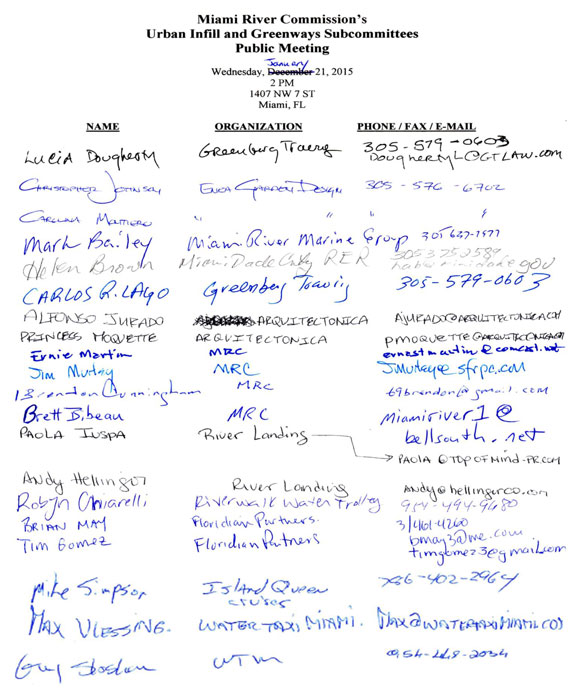
January 21, 2015 | THIS IS A PUBLIC DOCUMENT
The Miami River Commission’s (MRC) Urban Infill and Greenways Subcommittees conducted a combined public meeting on January 21, 2015, 2 PM, 1407 NW 7 Street. The attendance sign in sheet is enclosed. MRC Urban Infill Subcommittee Chairman Jim Murley and MRC Greenways Chairman Ernie Martin ran the meeting..
|
Miami River Commission’s
Urban Infill & Greenways Subcommittee’s Combined Minutes
I. Review Proposed “Ducote Marina” at Current “Campeones Marina and Boatyard”, 600 NW 7 Ave
Mr. Reinaldo Borges, Borges + Associates and Javier Avino, Bilzin Sumberg, presented plans for an 8-story, 100 foot tall structure, setback 20 feet from the Seybold Canal’s eastern shoreline at 600 NW 7 Ave, featuring a new seawall, 90 dry stack storage boat slips and a lift to launch them into Seybold Canal, seven residential live-work units, and 1st floor retail ie café / restaurant with outdoor seating and bait shop, vehicle parking.
Mr. Escobar stated he owns a boat house on the opposite shore of the narrow Seybold Canal and he is concerned he will no longer have navigational access to pull in and out of his boat house with 90 boat slips proposed on the opposite shore of the Seybold Canal.
Ms. Daeja O’Donoghue stated she owns and lives in a home in the designated historic Spring Garden Neighborhood, located directly across the Seybold Canal from the proposed mixed-use development. MS O’Donoghue stated her opposition to the proposal and concerns regarding parking overflow, height, and the invasion of her family’s privacy while living in their home.
Ms. Jo Winstead stated she owns and lives in a home in the designated historic Spring Garden Neighborhood, located across the Seybold Canal and just west of the historic humpback Bridge which is the northern property line from the proposed mixed-use development. Ms. Winstead stated her opposition to the proposal and belief the operation of the boat lift frequently launching the proposed 90 new dry stack boat slips into the Seybold Canal would violate the City of Miami’s existing noise ordinance.
MRC Director Bibeau stated Miami-Dade County DERM may not permit more than the number of wet slips currently allowed on this property per the site’s current Marine Operating Permit (MOP), which he recalled was significantly less than the proposed 90 slips, more like 30 slips (MRC’s 12/3/07 public meeting minutes for current “Campeone’s Boatyard, 600 NW 7 Ave, indicate 10 boat slips). In addition, Mr. Bibeau asked for further details regarding consistency with the public riverwalk requirements and specific dimensions of the various zones, such as the minimum 16-foot wide obstructed circulation zone, as required in the Miami 21 Zoning Code Section 3.11 and Appendix B.
MRC Urban Infill Subcommittee Chairman Murley and Greenways Subcommittee Chairman Martin asked the applicants to meet with Miami-Dade County DERM regarding their proposal, as the number of allowable slips will impact the proposed developments height, number of stories, number of vehicular parking spaces, etc. and provide further details regarding the public riverwalk, its connection to what would become a public riverwalk at the adjacent 3-story GLF headquarters which is currently under construction, and consistency with Miami 21. The applicants were invited to present to a future public meeting of the MRC subcommittees.
II) Public Miami Riverwalk’s Connection to the Existing “M-Path” / Planned “Underline” Beneath Metro-Rail
MRC Director Bibeau thanked Miami-Dade County for commencing construction of 2 new public riverwalk sections, located on the Miami River’s north and south shores beneath Metro-Rail. Ms. Meg Daly stated “Friends of the Underline” are advocating for improvements to the M-Path bicycle / pedestrian pathway and greenspace located beneath the M-Path, which would connect to the public riverwalk on the Miami River’s south shore to Dadeland South. Ms. Daly stated the County just selected their design firm and she hopes the public planning process will be complete by summer 2015. Ms. Daly stated a desire to also include a connection over the Miami River into Downtown Miami. MRC UIWG Chairman Murley noted the importance of programming and budgeting for maintenance. All parties agreed to maintain open communications regarding this important connection between bicycle / pedestrian infrastructure.
III) Waterborne Transportation
MRC Urban Infill Chairman Murley noted the recent Miami Today article, “City charts a waterways course to sink gridlock” which reported a recent City of Miami Commission resolution. Attendees noted the MRC has recommended waterborne transportation since adoption of the Miami River Greenway Action Plan (“Blueway”) in 2001, the Miami River Corridor Urban Infill Plan in 2003, and the Miami River Corridor Multi-Modal Transportation Plan in 2007 (MPO and MRC). In addition, the concept was studied in the MPO’s previous plans, MPO’s Service Plan Development for Waterborne Transportation Service in Miami-Dade County and the MPO’s Utilization of Miami-Dade County Waterways for Urban Commuting Travel. The related excerpts of the aforementioned plans were distributed, in addition to, “Palm Beach County Water Taxi Docks, July 2012”. Furthermore the concept is supported in the Miami Downtown Transportation Master Plan, DDA Master Plan, and the City of Miami Comp Plan.
Per the request of MRC Urban Infill Chairman Murley, Director Bibeau distributed copies of a map and the following corresponding list:
Miami Dade County Owned Public Riverwalk Sites Where Permission
Should be Granted for Private Sector Waterborne Transportation Providers
to Drop off and Pick-up Passengers
1) WASD Pump Station #1, between Lummus Park and 3 River Restaurants
2) Beneath 2 Ave Bridge North Shore
3) Beneath 2 Ave Bridge South Shore
4) Metro-Rail North Shore
5) Metro-Rail South Shore
6) “Riverwalk” Metro Mover Station
7) “5 ST” Metro Mover Station
MRC Urban Infill Chairman Murley and MRC Greenways Chairman Martin suggested the full MRC formally recommend Miami-Dade County allow ADA accessible, USCG certified, insured, etc. private sector waterborne transportation businesses to pick-up and drop-off passengers at the County owned riverfront sites.
IV) Southeast Florida Regional Freight Plan (Draft Report 2014 Update)
MRC Urban Infill Chairman Murley stated the Port of Miami River is finally rightfully included in Florida Department of Transportation’s Strategic Intermodal System (SIS) Plan, as recommended by the MRC for several years. Therefore the Port of Miami River is now eligible for significant multi-modal transportation funding. MRC Director Bibeau provided a tour of the Miami River to Carlos Castro, FDOT Freight Coordinator and Florida Enterprise. Chairman Murley encouraged the MRC to continue its successful advocacy in this regard, as recommended in the MRC / MPO Miami River Corridor Multi-Modal Transportation Plan.
V) New Business
MRC Director Bibeau distributed Board of County Commissioner’s Economic Prosperity Committee’s 2/12/15 agenda item 2(B), “to prepare a finding of necessity study for Orange Sports Complex Community Redevelopment Area” which includes the Miami River’s south shore from Flagler Bridge to NW 22 Ave Bridge. MRC Urban Infill Chairman Murley and MRC Greenways Chairman Martin noted the MRC’s adopted strategic Plan, the award winning the Miami River Corridor Urban Infill Plan, was created specifically consistent with State Statute 163 so it may become a redevelopment plan required when creating a new CRA, which the plan recommends for the Miami River District. MRC Urban Infill Chairman Murley and MRC Greenways Chairman Martin suggested the full MRC formally recommend Miami-Dade County adopt the subject item to prepare a finding of necessity study with one condition, allowing Miami River improvements, including but not limited to the public riverwalk, to be funded by the proposed new CRA which would include a substantial portion of the Miami River’s south shore.
MRC Director Bibeau reported the Annual FDOT Transportation Enhancement Program which provides Cities and Counties with $1 million federal grant awards to construct public Greenways etc has an open application cycle with applications due in April 2015. Every year the City of Miami submits average 6 applications to this program, and they have not submitted any Miami River Greenway applications for years. MRC Urban Infill Chairman Murley and MRC Greenways Chairman Martin recommended the City of Miami should file 2 grant applications to this $2 million fed greenway grant opportunity to fund on-road greenways along City owned north and south river drives from NW 17 Ave to NW 22 Ave, for example South River Drive in front of Sewell Park has no sidewalk at all.
The meeting adjourned.
The meeting adjourned.
|
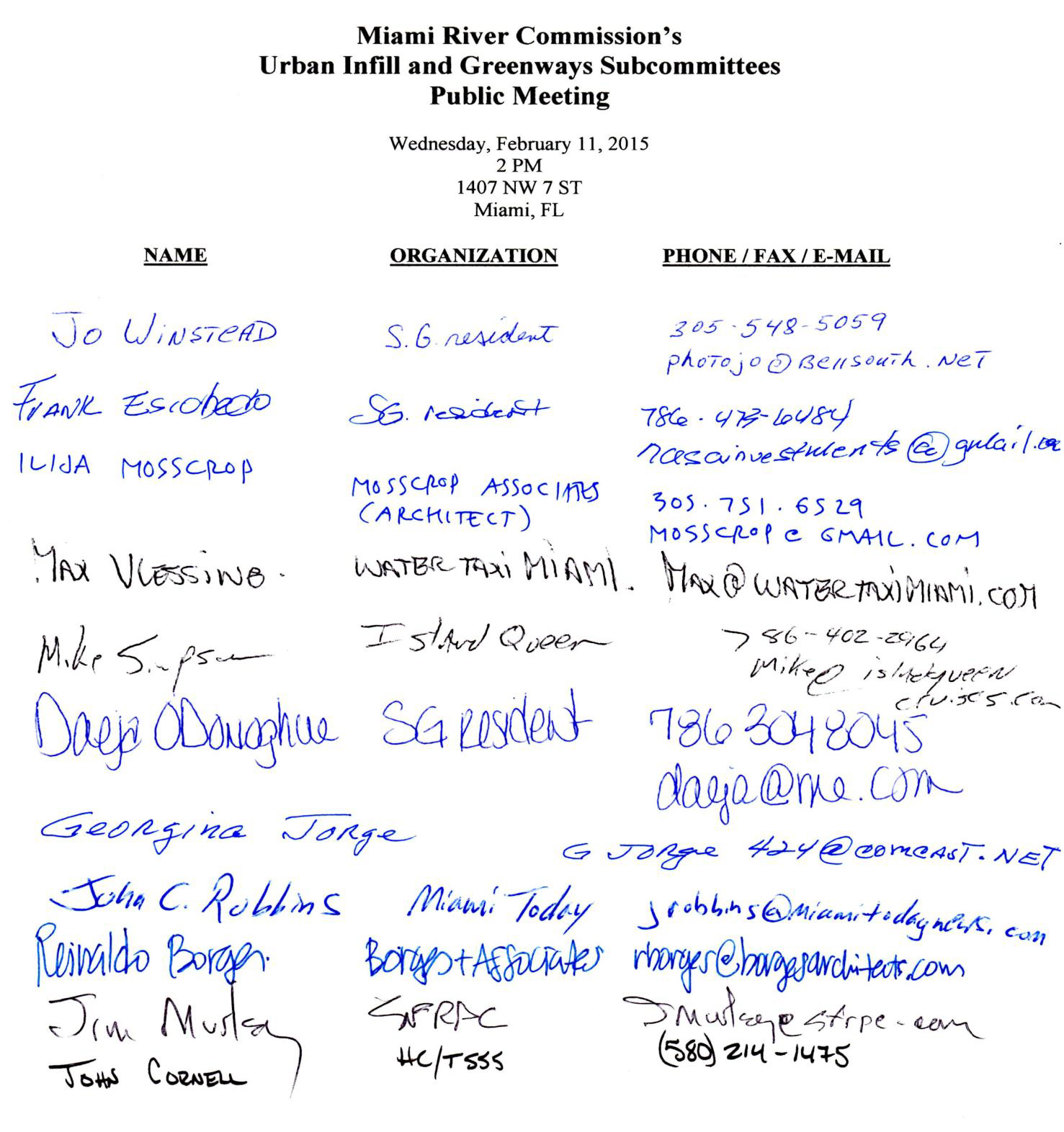
February 11, 2015 | THIS IS A PUBLIC DOCUMENT
The Miami River Commission’s (MRC) Urban Infill and Greenways Subcommittees conducted a combined public meeting on February 11, 2015, 2:00 PM, 1407 NW 7 Street. The attendance sign in sheet is enclosed. MRC Urban Infill Subcommittee Chairman Jim Murley and MRC Greenways Chairman Ernie Martin ran the meeting.
|
Miami River Commission’s
Urban Infill & Greenways Subcommittee’s Combined Minutes
I. Consideration of Proposed Development on the Miami River’s North Shore, West of Miami Ave Bridge, 24 SW 4 ST
Ms. Iris Escarra, Greenberg Traurig and Tsunehsia Tsuda, Rafael Vinoly Architects, presented plans for the Kar Properties proposed development, featuring 2 – 60 story residential buildings, including 402 residential units and 20 hotel rooms, 2,100 square feet of commercial / retail on the 1st floor and 30,000 square feet of commercial / retail space on the top 3 levels. The proposed development is seeking a Warrant to amend the sites previously approved Major Use Special Permit (MUSP), a warrant to maintain the previously approved MUSP’s reduction of the City Charter and Zoning Code required “view corridor” or side-yard setbacks, a waiver to reduce the parking requirements by 30% because the site is close to mass transit, a waiver to allow parking on the 2nd level, and a waiver in order to allow vehicular drop off in the frontage. Ms. Escarra provided the City of Miami’s Urban Design Review Board (UDRB) April 15 advisory recommendation to approve the development with one condition to “Create better activation along public space fronting the river.” Ms. Escarra stated the waivers and warrants are all administrative, and will occur after the MRC formulates its advisory recommendation.
Ms. Escarra stated the proposal will purchase an additional 480,000 on the top 24 stories of the 2 buildings at $13 per square feet is $6,240,000, and still considering purchasing these from a historically designated site instead of paying the City or actually constructing public improvements. Director Bibeau stated it would be helpful to all reviewers, especially the City of Miami, if the decision of how to secure the additional floors, square footage and significant additional density is determined before the developments are considered, because a development which invests millions of dollars in “public benefits” in the impacted subject area where the development is located is different if the same proposal instead purchases the additional density from a private sector historic land owner, therefore no public benefit funding is provided in the subject impacted area to offset the increase in density, and all forms of transportation and mobility should be an allowable “public benefit”, vehicular, bicycle, pedestrian, water taxi, etc.
Ms. Escarra stated the proposal includes a public riverwalk (for example pages Z203-Z206 and Z301), connecting at grade elevations with existing public riverwalk to the east beneath the S. Miami Ave Bridge where the temporary construction fences will be removed upon completion of the Miami Ave bridge repairs and construction of the proposed development and they are meeting with Alina Hudak, Miami-Dade County, to propose additional public benefits and improved connections to the existing public riverwalk beneath the Miami Ave bridge, and to the west with the existing public riverwalk at Ivy and Mint. The proposed waterfront building setback and public riverwalk are 65-78 feet wide, exceeding the 50’ minimum required by code, and features a 3-story, 30-foot tall waterfall. Ms. Escarra stated the site has a history of having a vessel, and they have hired Coastal Systems to assess the condition of the seawall and secure a permit to maintain rights to dock boats at the site. Director Bibeau noted the City of Miami issued a code violation on the condition of the site’s seawall which appears to have the adjacent upland sinking and slipping out the bottom of the seawall, therefore recommended having the seawall replaced before finishing construction of the public riverwalk and high-density development. Ms. Escarra stated the 2-towers are separated by 60’-64’ and they are counting the middle “Water Ave” between Ivy / Mint and Wind, as the proposed view corridor. Ms. Escarra stated the current guard gates will continue operating the way they do now (which is the same as the Brickell Key guard gate) in terms of accessing the public riverwalk. The guard stops the car, the driver indicates they are visiting the public riverwalk, the guard writes down the driver’s license and license plate numbers, and allows the driver to enter. In addition there are businesses inside the area, which also have visitors. Ms. Escarra stated they will be meeting with the Homeowners association regarding the proposed improvements to the water feature and access to the public riverwalk where the common area and publicly accessible “Water Ave” dead ends in to the public Riverwalk area.
Attendees again noted the importance of including the City of Miami’s adopted Miami River Greenway Design Standards and Guidelines, including but not limited to signage clearly indicating the public riverwalk, and the development team agreed to insert them into the next set of revised & amended plans.
Ms. Escarra again agreed to provide the “working river covenant” required by the City’s adopted comprehensive plan.
Ms. Escarra stated if the presented plans are amended in the future, they will bring the revised plans back to the MRC subcommittee and full MRC for consideration.
Attendees agreed to present revised plans to the MRC’s Urban Infill and Greenways April public subcommittee meeting, possibly followed by the full MRC on May 4, noon, 1407 NW 7 ST.
MRC Urban Infill Chairman Murley suggested the MRC find the proposal consistent with the Miami River Corridor Urban Infill Plan and the Miami River Greenway Action Plan subject to the following conditions:
1) Capture and use the developments impact fees and potential $6,240,000 in “Public Benefits” within the impacted Miami River District, including but not limited to mobility improvements such as further offsite expansions of the public riverwalk
2) Make improvements to “Water Ave”, including improvements for public access to the connecting public riverwalk
The item will be considered at the next public meeting of the full MRC, May 4, noon, 1407 NW 7 ST.
II) Consideration of Proposed Development at 5 SW South River Drive
Deferred to the next MRC Urban Infill and Greenways Subcommittee’s public meeting, May 18, 2 PM, 1407 NW 7 ST.
III) Consideration of Miami River SAP’s Plans to Improve Jose Marti Park
Deferred to the next MRC Urban Infill and Greenways Subcommittee’s public meeting, May 18, 2 PM, 1407 NW 7 ST.
IV) New Business
MRC Urban Infill Chairman Murley stated he is working on convening a meeting with FDOT, Department of State, City of Miami, Miami Parking Authority (MPA), Bob Carr, and the MRC, regarding the Brickell Bridge. Mr. Murley stated he recommends FDOT meet with all impacted parties and agencies to:
1) Find a better final solution to maximize safe and efficient vehicular, pedestrian and bicycle use at the Brickell Bridge. MRC Chairman Aguirre stated City Commissioners Sarnoff & Gort agree with the recommendation to restore the vehicular lane on the Brickell Bridge, which FDOT recently removed in the current “trial” project.
2) Seeking FDOT, DOS, and FHA cooperation to approve the long standing plans and Mr. Bob Carr’s revised archeological work plan for the MPA to be able to fund and construct improvements beneath the Brickell Bridge on the south shore, including but not limited to a public riverwalk and public paid parking.
Mr. Murley suggested a follow up meeting with the now contracted planners for the “Underline” (improvements to the existing public “M-Path” bicycle and pedestrian pathway beneath Metro-Rail) and its connection to the public riverwalk currently under construction beneath Metro-Rail. Mr. Murley noted based on the lessons learned along the public Riverwalk, both the Miami River Greenway and the Underline (M-Path) would benefit from increased maintenance, security and special events.
The meeting adjourned.
Miami River Commission’s Urban Infill Working Group
Development Technical Review Report
Project Name: “Miami River”
Project Address: Miami River’s North shore, west of Miami Ave Bridge, 24 SW 4 ST
Developer Name: Kam Properties
Contact Information: Iris Escarra, Greenberg Traurig , escarrai@gtlaw.com
Is the proposed development compatible with the “Miami River Corridor Urban Infill Plan” and the “Miami River Greenway Action Plan”? Yes, the proposed development is compatible with this “Lower River” site. For example, Miami River Corridor Urban Infill Plan, pg. 15 “Vision for the River” for this specific “Downtown” portion of the Miami River states in part, “The potential for this waterfront is greatly enhanced through a requirement that all new development and redevelopment provide active pedestrian uses oriented toward the river and a broad public ‘Riverwalk’ along the water’s edge…the Downtown waterfront is presently zoned for Central Business District (which) allows high-intensity mixed-use development appropriate to the downtown core” as proposed in the subject development. The proposed residential-mixed use development is setback 65-78 feet from the Miami River featuring a publicly accessible 65-78 foot-wide public Riverwalk (with a minimum 16-foot wide unobstructed pathway / “circulation zone), potential boat slips, etc.
Does the proposed project require any zoning amendments, land use amendments, special exceptions, waivers, or Special Area Plan? Yes, the proposed development is seeking a reduction in the City Charter and Zoning Code’s required view corridor (side-yards) from via a warrant to maintain the site’s previously approved reduction of the view corridor (side-yards) in this site’s previously approved Major Use Special Permit. In addition, the project is seeking a parking waiver to reduce the required parking spaces by 30%, because the site is close to mass transit, a waiver to allow parking on the 2nd level, and a waiver in order to allow vehicular drop off in the frontage.
Additional recommendations to optimize the positive impacts of the project on the Miami River Corridor and to improve coordination among public and private entities:
1) Capture and use the development’s impact fees and potential $6,240,000 in “Public Benefits” within the impacted Miami River District, including but not limited to mobility improvements such as further off-site expansions of the public Riverwalk, etc.
2) Make improvements to Water Ave, including improvements for public access to the connecting public riverwalk.
|
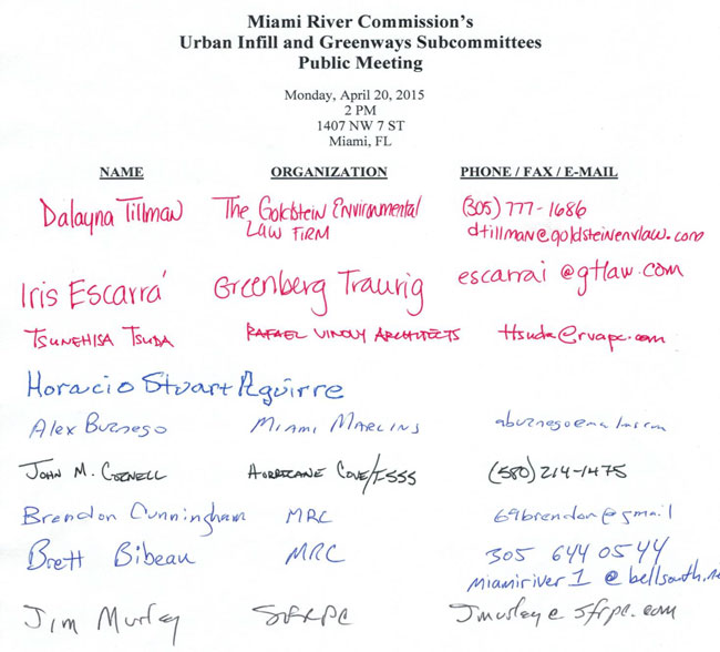
April 20, 2015 | THIS IS A PUBLIC DOCUMENT
The Miami River Commission’s (MRC) Urban Infill and Greenways Subcommittees conducted a combined public meeting on April 20, 2015, 2:00 PM, 1407 NW 7 Street. The attendance sign in sheet is enclosed. MRC Urban Infill Subcommittee Chairman Jim Murley ran the meeting.
|
Miami River Commission’s
Urban Infill & Greenways Subcommittee’s Combined Minutes
I) Update and Consideration of Plans to Replace the 1 ST Bridge
Michael Sileno, Hardesty Hanover, presented a 38 page PowerPoint, “SW 1 ST Bridge Replacement”. Mr. Sileno stated construction is estimated to be commenced starting in 2018 through 2021. Mr. Sileno highlighted the following improvements since the last presentation to the full MRC:
- $5 million was added to the project to include a 6-8 foot wide public riverwalk (standard is minimum 25-foot wide riverwalk featuring a minimum 15-foot wide unobstructed pathway) on both sides of the bridge beneath the 1 ST Bridge, behind the structure and directly along both shorelines
- Structures and fenders removed from the waterway to provide maximum navigational width
- Large art murals – Mark Bailey suggested the image reflect the “Working River” i.e. a vessels
- Reconstructs existing catwalks connecting to Historic Miami River Hotel
- Inserting Bike Lane
- Removing 1 vehicular lane (4 lanes becomes 3 lanes on this one-way street)
MRC Urban Infill Chairman Jim Murley stated this preliminary plan (30%) requires updates such as renditions of the proposed public riverwalks (potentially widening the Riverwalk) and improving the art murals, but seems to be generally consistent with the Miami River Greenway Action Plan and the Miami River Corridor Urban Infill Plan as it provides for a new Bridge and section of the public riverwalk.
II) Consideration of Miami River SAP’s Plans to Improve Jose Marti Park
Ms. Carli Koshal, Melissa Tapanes, Berkow Radell Fernandez, Troy Vaughn, Raymond Jungles, and George Puig, Kimley Horn and Associates, distributed and presented a 34 page set of plans to improve Jose Marti Park, to be funded by the Chetrit Groups “Miami Riverwalk” Special Area Plan. Development. The MRC previously recommended approval with conditions for the development on private property featuring a public riverwalk, and the MRC is now considering the plans for the Jose Marti Park Improvements which will be constructed, funded, and maintained by the Chetrit Group as part of their $21 million investment in the Miami River District in order to receive additional height and density under the “Public Benefits” program. Improvements to Jose Marti Park include:
- Constructing new riverwalk
- Seawall repairs including widening the narrower corner of the riverwalk next to pool
- Renovating pool building, locker rooms, & pool deck
- Removing the closed kiosk
- Relocating trees to make an open lawn (Bibeau recommended keeping palms on upland edge of new riverwalk)
- Removal of all fencing around park (ie Kennedy park) and providing 24/7 security in the Park
- New small restroom building (Bibeau questioned new bathrooms located feet from existing bathrooms in community center and attendees wondered about operating hours)
- New Playground
- New Sculpture climbing
- New Splash fountain
- New outdoor exercise equipment
The development team clarified SW 3 Ave along the Federal funded on-road Miami River Greenway from SW 6 ST to the Miami River will have a sharrow, not a “bike lane”, in order to maintain the wide sidewalks, landscaping, benches, trash cans, signage, etc.
Director Bibeau noted no improvements are planned for the SW corner of the park beneath I-95 which is currently an unsightly dump, and recommended inserting tennis courts and or racquetball courts in this shaded area
MRC Urban Infill Chairman Murley recommended convening a meeting with the new City of Miami Parks Director Kevin Kirwin, development team and the MRC.
The “Miami Riverwalk” Special Area Plan will be considered by the Planning Zoning and Appeals Board on June 3, and the City Commission on July 23. MRC Chairman Aguirre will consider placing this item on the full MRC’s June 1 or July public meeting agenda.
III) Consideration of “Wagner Creek Multi-Family Residential Development”, 1050-1080 Spring Garden RD
MRC Director Bibeau provided the following email and referenced “Wagner Creek Multi-Family Residential Development” plans, located on Wagner Creek at 1050-1080 Spring Garden Road:
“Dear Mr Stubins:
Per our emails below and our subsequent conversation, I respectfully disagree with your assertion that the Related Group Plans attached to your sales brochure for the “Wagner Creek Multi-Family Residential Development” are as of right. Rather, per my preliminary review it appears the plans would require City Commission to waive Zoning Code requirements for having a surface parking lot to close to the waterfront, missing a side-yard public ped access path to public Riverwalk, maybe needs a waterfront building setback waiver from City Commission (all contained within City zoning code Miami 21’s “Waterfront Standards” Section 3.11). Therefore the Miami River Commission’s subcommittee cordially invites the “Wagner Creek Multi-Family Residential Development” representatives (owner, architect, realtor, etc) to present the plans attached to your sales brochure to the advisory Miami River Commission’s subcommittee (Urban Infill and Greenways) meeting on 5/18, 2 PM, 1407 NW 7 ST, in the “class room” facing the River.” The invited parties did not attend the public meeting.
IV) Discussion of “Public Benefits” in Miami 21
MRC Director Bibeau provided a copy of Miami 21 Section “3.14 Public Benefits Program”. The MRC has been recommending allowing developments within the Miami River District to include the possibility of mobility & transportation improvements to be inserted into the law in order to become an allowable use of “Public Benefit” funding.
The meeting adjourned

|
May 18, 2015 | THIS IS A PUBLIC DOCUMENT
The Miami River Commission’s (MRC) Urban Infill and Greenways Subcommittees conducted a combined public meeting on May 18, 2015, 2:00 PM, 1407 NW 7 Street. The attendance sign in sheets are enclosed. MRC Urban Infill Subcommittee Chairman Jim Murley ran the meeting.
|
Miami River Commission’s
Urban Infill & Greenways Subcommittee’s Combined Minutes
I) Consideration of Miami River SAP’s Plans to Improve Jose Marti Park
Ms. Melissa Tapanes, Carli Koshal, Berkow Radell Fernandez, Troy Vaughn, Raymond Jungles, and Kim Misek, Kimley Horn and Associates, and Ari Pearl, CG Miami River LLC, distributed and presented a revised and improved 34 page set of plans to improve Jose Marti Park, to be funded by the Chetrit Groups “Miami Riverwalk” Special Area Plan (SAP) mixed-use development (original plans presented to MRC Urban Infill and Greenways subcommittee on May 18, 2015). The MRC previously recommended approval with conditions for the development on private property featuring a public riverwalk (October 6, 2014), and the MRC is now considering the plans for the Jose Marti Park Improvements which will be constructed, funded, and maintained by the Chetrit Group as part of their $21 million investment in the Miami River District in order to receive additional height and density under the “Public Benefits” program. Improvements to Jose Marti Park include:
- Constructing new riverwalk
- Seawall repairs including widening the narrower corner of the riverwalk next to pool
- Renovating pool building, locker rooms, & pool deck
- Removing the closed kiosk
- Relocating trees to make an open lawn (Bibeau recommended keeping palms on upland edge of new riverwalk)
- Removal of all fencing around park (ie Kennedy park) and providing 24/7 security in the Park
- New small restroom building (Bibeau questioned new bathrooms located feet from existing bathrooms in community center and attendees wondered about operating hours)
- New Playground
- New sculpture climbing
- New Splash fountain
- New outdoor exercise equipment
- New art installation (to be reviewed by Miami-Dade County’s Arts Council)
The developer team noted the updated plans to improve Jose Marti Park were led by the co-applicant which is the City of Miami, and now the plans to improve the public riverwalk in Jose Marti Park is wider than before and exceeds the minimum unobstructed riverwalk width (15’ circulation zone) required in the City Code. The developer team stated they will submit updated plans which further reduces the width of the landscaping directly on the River’s shoreline, consistent with City Park’s Director Kirwin’s request.
The development team clarified SW 3 Ave along the Federal funded on-road Miami River Greenway from SW 6 ST to the Miami River will have a sharrow, not a “bike lane”, in order to maintain the wide sidewalks, landscaping, benches, trash cans, signage, etc.
Director Bibeau noted no improvements are planned for the SW corner of the park beneath I-95 which is currently an unsightly dump, and recommended inserting tennis courts and or racquetball courts in this shaded area. In a recent meeting, City of Miami Parks Director Kevin Kirwin agreed to make needed improvements to this unimproved SW corner of Jose Marti Park using impact fees generated from the proposed development. In addition, Director Bibeau stated Jose Marti Park’s public pool used to have 2 popular diving boards, one “low” and one “high” dive. Director Bibeau stated he recently visited a public pool in a park in Key Largo, and their diving boards (“low” and “high”) were very popular, well used and enjoyed by all the pool users. Therefore Director Bibeau recommended using the subject developments public benefit funding and or impact fees to return the low and high diving boards into the Jose Marti Park pool.
Ms Sallye Jude recommended the developer give their Public Benefit funding directly to the City of Miami, which would construct the actual improvements, and the developer replied they plan to construct the planned improvements, which have an equal value.
Ms. Jude recommended more of a public process and including the Trust for Public Land. Ms Tapanes replied the developer team has presented their plans for Jose Marti Park improvements which were developed under the leadership of their co-applicant City of Miami, to MRC subcommittee in 2 public meetings, in addition to public meetings with the “Little Havana Property Owners Association”, “Little Havana Merchants Alliance”, and the “Friends of Little Havana”. Ms Tapanes stated per Ms Jude’s recommendation they would reach out and communicate with the Trust for Public Land as well.
The “Miami Riverwalk” Special Area Plan will be considered at public meetings by the City Commission at 2 readings, on July 23 and in September, and MRC Chairman Aguirre will place this item on the full MRC’s July 13 public meeting agenda, noon, 1407 NW 7 ST.
The Developer team agreed to provide updated revised plans no later than July 6, which will also include a rendition of the new playground equipment, etc.
Jim Murley recommended the full MRC find the proposed improvements to Jose Marti Park to be consistent with the Miami River Greenway Action Plan and the Miami River Corridor Urban Infill Plan subject to improving identification of the public riverwalk’s intended route and its connection to the on-road Greenway at the NW end of the Park, onto SW 4 Ave and SW 2 ST.
The meeting adjourned.
|
June 23, 2015 | THIS IS A PUBLIC DOCUMENT
The Miami River Commission’s (MRC) Urban Infill and Greenways Subcommittees conducted a combined public meeting on June 23, 2015, 10:00 AM, 1407 NW 7 Street. The attendance sign in sheets are enclosed. MRC Urban Infill Subcommittee Chairman Jim Murley ran the meeting.
|
Miami River Commission’s Urban Infill Subcommittee’s Minutes
I) Consideration of Submitted Bids to City of Miami Request for Proposals (RFP) to Lease City Owned 236-298 NW North River Drive
The City of Miami advertised a Request for Proposals (RFP) to lease City owned 236-298 NW North River Drive. The RFP requires proposals to be consistent with the existing Marine Industrial D3 zoning and Port of Miami River Land Use. The City site has been leased under a monthly “license agreement” to Garcia’s commercial fishing for the past 45 years. MRC UIWG Chairman Murley stated he appreciated the RFP requiring bids to be consistent with the site’s current marine industrial land use and zoning. The City’s deadline to submit bids has passed and the City received the following 1 proposal / bid.
Mr. Alex Mantecon distributed and presented the submitted proposal / bid for the “Riverside Wharf”. On the presented plans, “Site 2” are the parcels owned by the City of Miami, and the adjacent riverfront “Site 1” to the North West is owned by Mr. Mantecon. “Site 2” consists of 2, 3-story buildings featuring a fish market, commercial fishing vessel dockage, and 2 restaurants, all featuring a publicly accessible Riverwalk. Mr. Mantecon stated Willy Bermello’s design creates a juxta position of maritime industrial vocabulary to recall the area’s past, within a modern framework of sculptural steel, sheet metal, concrete and glass. The adjacent site to the south east of the City parcels was rented by Mr. Mantecon from Mr. Manny Prieguez, in order to connect the public Riverwalk to the east with the existing public Riverwalk which proceeds east beneath I-95, past the City Administration Building, etc. Mr. Prieguez confirmed this statement of fact. Luis Garcia stated his family has rented the City owned property and generated commercial fishing jobs for the past 45 years on a month to month basis, which therefore gave him no opportunity to improve the City parcels as desired. Therefore, Mr. Garcia stated he is glad his commercial fishing business is part of the only submitted bid for the City’s advertised long term lease, which will now allow the City’s parcels to be substantially improved. Mr. Garcia stated he has visited successful Fisherman Wharf’s in other waterfront cities, and hopes to make one on the Miami River. Mr. Mantecon stated the area’s planned Fisherman’s Wharf is becoming a reality, for example the subject development is adjacent to the Sushi Samba self-standing restaurant which is about to break ground on North River Drive between the 1 ST and Flagler Bridges, and will also feature a connecting section of the public Riverwalk. Mr. Mantecon noted the City’s parcels would be very difficult to develop on their own without his adjacent private property, because the City parcels have an odd shape, 5 sides, adjacent to I-95, restricted uses by the current Port of Miami River Land Use and D3 Marine Industrial zoning, difficult vehicular access, and the $195,500 per year minimum rent plus 3-5% increases per year plus a percentage of revenue, for a total minimum guaranteed rent in excess of $22 million over the life of the lease. Mr. Mantecon stated the proposal requires no amendments to the land use and zoning, and the public Riverwalk is 15-feet wide and is consistent with Zoning Code Section 3.11 and the City Charter. Mr. Mantecon stated he is in negotiations with the Miami Parking Authority whom controls numerous large public paid parking lost beneath adjacent I-95 which empty after 5 PM when the restaurants would start getting busier. Mr. Mantecon stated the advertised RFP schedule has the submitted bid being considered by the City Commission in November, followed by a vote by the entire public at referendum. Mr. Mantecon stated he was informed the City of Miami was considering throwing out the RFP and submitted bid but didn’t know why. Mr. Mantecon noted he was ready to break ground before the scheduled replacement of the adjacent 1 ST Bridge in 2017, and a delay in the process would jeopardize any development occurring in the area until after the bridge is replaced several years from now. The Miami River Corridor Urban Infill Plan states the following about this specific subject area on page 22, “Consideration should be given to relaxing roadside setbacks, and /or parking requirements for all of these waterfront sites in exchange fpr development that embraces the water’s edge as a public amenity, provides active pedestrian oriented uses along North River Drive, and respects the scale and character of the historic Lummus Park neighborhood.” MRC Urban Infill Subcommittee Chairman Murley recommended the full MRC find the presented City owned “Site 2” plans to be consistent with the adopted Miami River Corridor Urban Infill Plan and the Miami River Greenways Action Plan.
Mr. Mantecon proceeded to present the plans for his adjacent owned land shown on the plans as “Site 1” (114 SW North River Drive and 300 SW 2 ST). The plans consist of 2 more riverfront 3 story restaurants, again featuring the minimum 15-foot wide public Riverwalk connecting to the east with the public Riverwalk at “Site 1” and connecting to the west with the public Riverwalk proposed at the planned 1 ST Bridge replacement. “Site 1” and “Site 2” together have 60% useable open space available to the public, a continuous needed 15-foot wide section of the public Riverwalk along 599 linear feet of the Miami River, connecting with public Riverwalks to the east at I-95 and to the west at 1 ST Bridge, which will feature a new needed seawall and maintain dockage for 18 vessels, consistent with the sites current Marine Operating Permits and submerged land leases which will be maintained, 3 plaza and breezeways entries providing view corridors to pedestrians and motorists along North River Drive, 4 restaurants, a fish market, combined air conditioned space of 33,073 square feet, seating capacity of 1,200 seats, projected to generate 300 permanent jobs and saves the site’s current 30 commercial fishing jobs. The City of Miami’s Comprehensive Plan specifically calls for a “Fisherman’s Wharf” in this part of the Miami River. MRC Urban Infill Chairman Murley recommended the full MRC find the combined proposed development of both “Site 1” & “Site 2” provides a great attraction and Fisherman’s Wharf, and is consistent with the adopted Miami River Corridor Urban Infill Plan and the Miami River Greenway Action Plan.
II) Consideration of City of Miami’s Plans to Sell Riverfront 444 SW 2 Ave (City Office Building) and Adjacent Riverfront 460 SW 2 Ave (Public Park with Riverwalk and 3 Boat Slips)
City Manager Daniel Alfonso presented the item on behalf of the City of Miami. City Manager Alfonso stated land along the Miami River has become very valuable; therefore the City of Miami’s “Miami Riverside Center” Office building is not the “highest and best use” of the site, which with the public benefit program could have an 80-story building. City Manager Alfonso stated the City of Miami is working on a Request for Proposals (RFP) to “swap” their existing office building for a new custom building designed and constructed to meet the needs of the City of Miami administration and its various visitors. Manager Alfonso stated the new building must be located somewhere south of NW 20 ST and east of Lejeune Ave. Manager Alfonso explained stated if there is a difference in value after the building swap, the difference would be paid to the City of Miami, and the deal would have to be approved at referendum by the voters of the City of Miami.
Print outs from the Miami-Dade County Tax Appraiser Website were distributed for the following 2 subject City owned parcels.
444 SW 2 Ave - Currently the City of Miami’s 10-story office building features ample parking in the site’s 4-story parking garage, and adjacent public parking lots beneath I-95. The City of Miami and its employees are a wonderful part of the Miami River District, but we understand if the City of Miami sees the financial opportunity in selling what has become a very valuable riverfront office building.
460 SW 2 Ave is a publicly accessible 1.3 acre riverfront public open green park space, featuring the public Riverwalk and 3 boat slips. Manager Alfonso noted the site is not zoned Parks and Recreation, and MRC Director Bibeau agreed but noted it serves like a public park featuring the public Riverwalk. MRC Director Bibeau stated the adopted Miami River Corridor Urban Infill Plan page 90 states, Provide additional Greenspace where feasible within the Urban Infill Boundary.” The City of Miami has amongst the least park space of any large City in the Country. In addition, the sites 3 excellent water slips are extremely important for the City of Miami. For example, for aver a decade the City of Miami has provided a slip at this location for their contracted Scavenger Water Decontamination Vessel, which per their contract the City is responsible to provide the vessel free dockage, water and power. The remaining boat slips maybe utilized by City of Miami Marine Patrol, Fire Fighting Vessel, and or lease a slip to provide reoccurring revenue to maintain this beautiful public riverfront park space in Miami’s downtown core.
MRC Urban Infill Chairman Murley suggested the Miami River Commission recommend the City of Miami maintain ownership of 460 SW 2 Ave, or provide covenants and guarantees that any future owner will maintain its current use which serves as an undeveloped public park with a public Riverwalk and three valuable waterfront slips which could generate re-occurring revenue source to fund maintenance of the public park and public Riverwalk. Chairman Murley suggested the MRC further recommend the City of Miami increase its riverfront public park space, do not lose riverfront public greenspace, and host a public planning process of how the reserved park space might be better integrated into the public Miami River Greenway.
The MRC Urban Infill Working Group thanked Manager Alfonso for attending and presenting the item, and invited him to do so when the item is considered by the full MRC during the October 5 public meeting, noon, 1407 NW 7 ST.
III) Consideration of City of Miami Planning Department Zoning Amendment for Riverfront 109 SW South River Drive and the Miami River Inn (part of a larger City of Miami Zoning amendment application for certain properties in Little Havana)
The City Commission approved at 1st reading several months ago a City of Miami Planning Amendment application from T4 to T5 for numerous properties in Little Havana, including riverfront 109 SW South River Drive and the Miami River Inn.
Manny Prieguez stated he owned 109 SW South River Drive, does not have a vote at the MRC subcommittee, and will recuse himself from the vote when this item is considered by the full MRC. Mr. Prieguez stated he is attending the public meeting for information only.
Attendees noted Mr. Prieguez owns three riverfront parcels, two of which are currently zoned T-6, where the City Zoning Code requires the public Riverwalk in new developments. The subject riverfront parcel is zoned T4, in which the City Zoning Code does not require a public Riverwalk, but if the parcel is rezoned to T5, the code would require the public Riverwalk.
Avra Jain, new owner of the historic Miami River Inn, stated she supports the item, for her property because when the City switched from Zoning Code 11000 to the current Miami 21 zoning code, the assigned T4 zoning made the operational Miami River Inn a non-confirming use where lodging is not allowed, therefore it is becoming difficult to obtain renovation permits. The Miami River Inn would again become a legal and confirming use, if the proposed zoning amendment to T5 is approved. MS Jain added City Planning Director Garcia informed her the City Commission will consider this item at 2nd reading in October.
MRC Urban Infill Chairman Murley suggested the MRC opine only on the Riverfront parcel and the Miami River Inn within this much larger rezoning item, and find those 2 parcels rezoning to T5 to be consistent with the Miami River Corridor Urban Infill Plan and the Miami River Greenway Action Plan.
The item will be considered during the MRC’s October 5 public meeting, noon, 1407 NW 7 ST.
IV) Consideration of City of Miami’s Transportation Trust Fund
MRC Managing Director Bibeau distributed copies of the City of Miami’s Transportation Trust Fund which was approved at 1st reading, which dedicate funding for transportation improvements. City Manager Alfonso stated the item maybe improved before being considered by the City Commission at 2nd reading in November. Director Bibeau noted one improvement is being recommended by MRC Board Member and City Commissioner Frank Carollo to create a new Transportation Impact Fee to be assessed on new developments of which funding would be placed into the Transportation Trust. MRC Infill Chairman Murley asked if the item allows all forms of transportation to be eligible for potential funding, including but not limited to Waterborne Transportation, the public Riverwalk, Miami River Bridge improvements i.e. smart signage, etc. Manager Alfonso replied he believes it does allow expenditures for potential Waterborne Transportation, but the public Riverwalk is probably not an eligible expense in the current draft. Manager Alfonso noted the County receives the overwhelming majority of Transportation funding via the ½ penny sales tax, gas tax, etc., therefore the County must remain the primarily responsible agency to fund transportation improvements County wide, including within the City of Miami.
MRC Urban Infill Chairman Murley suggested the MRC recommend approval of the concept of a Transportation Trust, which maybe improved before 2nd reading, and recommends the item include the public Riverwalk, Miami River Bridge improvements i.e. smart signage etc., and Waterborne Transportation as potential eligible expenses.
V) New Business
City Manager Alfonso stated he has been meeting with City staff regarding the need to demolish the “Temporary” Epic Sales Center which was constructed inconsistent with the City required waterfront building setback requirement. Attendees thanked the City Manager and noted this has been a long standing MRC recommendation.
Urban Infill Chairman Murley asked about Fort Dallas Park, located on the North Shore near the “Riverwalk” Metro-Mover Station and featuring the Historic Flagler Worker’s House, former location of Bijan’s Restaurant but vacant for a couple years. City manager Alfonso replied the City is working with the Hyatt and James L Knight Convention Center on a larger RFP for the area, which they will present in the future to the MRC. MRC Managing Director stated considering the RFP process could take a year, there have been parties whom have expressed interest in entering into the City’s month to month “lease agreement” in “as-is” condition which would generate income for the City and provide a tenant in the site which would help with needed maintenance, etc. The City Manager was receptive to the concept to exploring that option.
Attendees again thanked the City of Miami Manager Alfonso for participating in the important public MRC subcommittee meeting.
The next MRC Urban Infill and Greenways subcommittee meeting is the 3rd Wednesday of the month, October 21, 3 PM, 1407 NW 7 ST.
The meeting adjourned.
|
September 23, 2015 | THIS IS A PUBLIC DOCUMENT
The Miami River Commission’s (MRC) Urban Infill Subcommittee conducted a public meeting on September 23, 2015, 3:00 PM, 1407 NW 7 Street. The attendance sign in sheet is enclosed. MRC Urban Infill Subcommittee Chairman Jim Murley ran the meeting.
|
Miami River Commission’s Urban Infill Subcommittee & Greenways Siubcommittee’s Minutes
I) Consideration of Development Proposal for 1170-1180 NW 11 ST and 1080 NW 11 CT, Approved by Historic and Environmental Preservation Board with Conditions
MRC Director Bibeau stated on November 2 the full MRC adopted a unanimous resolution asking for this item to be presented to the MRC subcommittee today, followed by the full MRC on December 7, noon, 1407 NW 7 ST. MRC Urban Infill Chairman Murley stated many years ago the MRC had previously considered a different development, “River Garden” which was being proposed at that time for this same site. Dr Martin stated he is the President of the Spring Garden Civic Association, which just filed an appeal on this item to be considered by the City Commission, therefore recused himself from the item.
Ethan Wasserman and Ryan Bailine, Greenberg Traurig, and Albert Cordoves, Architect, presented and distributed plans for “Modera River House”, proposed by “Mill Creek Residential Trust”. The proposed development consists of:
• 1170 NW 11 ST – 233 residential rental units, 8 stories, 383 parking spaces. Currently zoned T6-8.
• 1080 NW 11 CT – 30 residential rental units, 5 stories, 45 parking spaces and restoring existing home to be used as a library and the Spring Garden Civic Association may use it for meetings monthly, max 12 times per year, 4 hours each with 15 days notice. Currently zoned T5.
• 1180 NW 11 ST – 29 residential rental units, 5 stories, 44 parking spaces. Currently zoned T5.
The development team proposes to improve and maintain the public pedestrian and bicycle pathway in between the 12 Ave Bridge and the proposed 8-story building.
Kathi Gibson and Gioia DeCarlo, Spring Garden residents, stated their main desire is for the largest parking garage entrance and exit be moved off of North River Drive where traffic would cross the on-road Miami River Greenway and proceed through the historically designated Spring Garden neighborhood as presented. Instead they recommended the parking entrance and exit be located on NW 11 ST and or NW 11 CT with means to channel the traffic towards NW 11 ST and away from North River Drive, the Miami River Greenway and the historic Spring Garden neighborhood. The presented plans remove an existing vehicular traffic land on NW 11 ST, and the residents recommend keeping this existing vehicular traffic lane on NW 11 ST. Attendees discussed the west elevation’s 4 story parking garage façade “Metal Grille Detail” pictured in the plans on page A-4.00.
MRC Urban Infill Chairman Murley recommended approval of the proposed development, and finding it consistent with the Miami River Corridor Urban Infill Plan and the Miami River Greenway Action Plan subject to the following conditions:
1) Minimize vehicular entrance and exit to parking structure from North River Drive and relocate them to NW 11 ST and 11 CT channeling the cars towards NW 11 ST as much as possible, without blocking NW 11 CT, in order for the cars to avoid the Miami River Greenway and historic Spring Garden Neighborhood
2) Leave all existing vehicular lanes operational on NW 11 ST (do not remove an existing vehicular lane as depicted) and create / implement a coordinated transportation plan for the area
3) Improve the parking garage façade
4) More intensive planning, improvements and maintenance of the existing public pathway along the NE side of the NW 12 Ave Bridge, which connects pedestrians and bicycles from NW 11 ST to North River Drive and the Miami River Greenway
II) Consideration of Miami River Inn’s, 118 SW South River Drive, Approved Historic and Environmental Preservation Board Item Avra Jain, owner of the Miami River Inn, distributed copies of the City of Miami Planning Department’s Staff Report and Recommendation and the item approved by the HEP board. The approval has been appealed to the City Commission.
Ms. Jain stated when the Miami River Inn was rezoned along with every parcel in the City, it’s historic Hotel use was zoned out of compliance under T4. Therefore she had previously presented, and the MRC previously recommended approval of the City of Miami’s application to rezone numerous sites in Little Havana, including the Miami River Inn, from T4 to T5, so that the Miami River Inn would become a legal conforming use. That item was approved by City Commission several months ago, and usually the 2nd reading is considered within a month, but the item has not returned to the City Commission for 2nd reading. Therefore, Ms. Jain explained the distributed item recently approved by the City of Miami’s Historic and Environmental Preservation board accomplished the same goal of the historic Miami River Inn becoming a legal conforming use. Ms Jain clarified a potential future restaurant at the Miami River Inn site, with a hot kitchen etc, is not included in this item, has not been planned to date, and will be presented to the MRC in the future when and if plans are prepared. The “Restaurant” referred to the distributed approved item is the same small area where the Miami River Inn has historically offered breakfast for guests, not installing a new full kitchen rather using what is there and previously used for the same purpose.
MRC Urban Infill Subcommittee Chairman Murley and Greenways Subcommittee Chairman Martin recommended the full MRC support upholding the City of Miami Historic and Environmental Preservation Board’s approved item regarding the Miami River Inn, because it is consistent with the Miami River Corridor Urban Infill Plan and the Miami River Greenway Action Plan.
III) New Business
MRC Director Bibeau stated MRC Chairman Aguirre and he met with City Commissioner Gort, whom agreed the City of Miami will apply for Federal TEP Grants for $2 million to construct the public Miami River Greenway along both sides of the Miami River, from 17 Ave proceeding west. Commissioner Gort asked for a follow up meeting with the City of Miami’s CITP and Grants Department, and all attendees met on October 26 and thankfully reaffirmed this commitment.
The MRC coordinated and funded a volunteer Miami River Greenway cleanup on 10/24. The next MRC coordinated and funded volunteer Miami River Greenway cleanups will be held 11/10 with Marlins Ayudan, and 11/21 with Hands on Miami.
Consistent with previous meetings and communications, MRC Urban Infill Subcommittee Chairman Murley & MRC Greenways Subcommittee Chairman Martin recommended if and when the conceptually planned “Underline” on the Miami River’s South Shore moves forward on the riverfront block from SW 7 ST to the new section of public Riverwalk, a more detailed joint planning with the Miami River Commission occur and incorporate the recently completed section of the public Riverwalk (which was co-funded with a matching FIND grant which requires it remain in place) and Waterborne transportation.
MRC Greenways Subcommittee Chairman Martin stated City Commissioner Keon Hardemon wants the Underline to continue further north beneath Metro-Rail into Overtown etc. MRC Greenways Subcommittee Chairman Martin and MRC Urban Infill Subcommittee Chairman Murley recommended Underline consider continuing north of their currently planned terminus, MRC Urban Infill Subcommittee Chairman Murley using an existing Bridge.
Miami River Commission’s Urban Infill Working Group Development Technical Review Report
Project Name: “Modera River House”
Project Address: 1170 NW 11 ST, 1080 NW 11 CT, & 1180 NW 11 ST
Developer Name: Mill Creek Residential Trust
Contact Information: Ethan Wasserman (wassermane@gtlaw.com) 305 579 0784 and Ryan Bailine (bailiner@gtlaw.com) 305 579 0500, Greenberg Traurig
Is the proposed development compatible with the “Miami River Corridor Urban Infill Plan” and the “Miami River Greenway Action Plan”? Yes, the proposed development is compatible with this “Middle River” site with following conditions, as it does not propose to amend or increase the existing T5 and T6-8 zoning:
1) Minimize vehicular entrance and exit to parking structure from North River Drive and relocate them to NW 11 ST and 11 CT channeling the cars towards NW 11 ST as much as possible, without blocking NW 11 CT, in order for the cars to avoid the Miami River Greenway and historic Spring Garden Neighborhood
2) Leave all existing vehicular lanes operational on NW 11 ST (do not remove an existing vehicular lane as depicted) and create / implement a coordinated transportation plan for the area
3) Improve the parking garage façade
4) More intensive planning, improvements and maintenance of the existing public pathway along the NE side of the NW 12 Ave Bridge, which connects pedestrians and bicycles from NW 11 ST to North River Drive and the Miami River Greenway
Does the proposed project require any zoning amendments, land use amendments, special exceptions, waivers, or Special Area Plan? The proposed development does not require any zoning amendments or land use amendments but does still require an agreement with FDOT to allow the proposed improvements and maintenance of the public pathway partially on FDOT public Right of Way which is an existing public pathway along the NE side of the 12 Ave Bridge.
Miami River Commission’s Urban Infill Working Group Development Technical Review Report
Project Name: “Miami River Inn” (approved HEP Item)
Project Address: 118 SW South River Drive
Developer Name: Avra Jain
Contact Information: Francine Madera, Francine@fmadera.com
Is the proposed development compatible with the “Miami River Corridor Urban Infill Plan” and the “Miami River Greenway Action Plan”? Yes, continued Miami River Inn operations by making it a legal conforming use is compatible with the Miami River Corridor Urban Infill Plan, which states on page 26, “East Little Havana remains a significant historic resource associated with the early development of Miami…consideration should be given to modifying the zoning of the multifamily residential parcels on the south side of South River Drive to allow limited restaurant, retail or office use”.
Does the proposed project require any zoning amendments, land use amendments, special exceptions, waivers, or Special Area Plan? Yes, the City of Miami’s Historic and Environmental Preservation Board’s approved item includes three exceptions pursuant to CH 23-6.1 to allow the historic Miami River Inn to continue operating as a legal confirming use.
The meeting adjourned.
|
November 18, 2015 | THIS IS A PUBLIC DOCUMENT
The Miami River Commission’s (MRC) Urban Infill and Greenways Subcommittees conducted a joint public meeting on November 18, 2015, 3:00 PM, 1407 NW 7 Street. The attendance sign in sheet is enclosed. MRC Urban Infill Subcommittee Chairman Jim Murley and MRC Greenways Subcommittee Ernie Martin ran the meeting. |
Miami River Commission’s Greenways Subcommittee’s Minutes
I) Consideration of “Naheem Kahn” Project, 1175 NW South River Drive
The development team indicated they are partially re-designing the plans and requested a deferral to subcommittee in Jan. 2016 and full MRC on Feb. 1, noon, 1407 NW 7 ST.
II) Consideration of 250 Biscayne Blvd. Way and 300 Biscayne Blvd. (“Epic” Phase II) Application for a Temporary Public Riverwalk and 2nd “Final” Extension of Time for the Existing “Temporary Sales Center” Structure Which the City of Miami Previously Required to Be Demolished for Violating City Charter and Zoning Code Waterfront Development Setback Requirements
A October 13, 2009 City of Miami memorandum states, “Pursuant to Section 1706, Zoning Ordinance 11000, it is hereby directed that this memorandum modifies the development order for the Dupont (n/k/a Epic) Major Use Special Permit, by approving the final extension of time for the temporary Sale Center and /or construction office until January 2012. The temporary Sale center and / or construction office shall be demolished in accordance with final date of extension time.”
City of Miami’s subject “Dupont Towers (Epic) Project Major Use Special Permit Development Order” states:
“14. The applicant shall comply with all of Section 2 of the Design Standards and Guidelines for baywalks/riverwalks and shall also ensure for the connectivity to the adjacent riverwalks.
15. The applicant shall provide public access to waterfront walkways/riverwalks as stated in Section 401 (CBD) of the City Zoning Code.”
The sites previously approved MUSP’s public Riverwalk is the total width of both the upland and dock portions of the public Riverwalk. The original plans for the 5 foot wide dock portion of the public Riverwalk were to be made of concrete with the cleats on the outside of the dock, allowing safe passage of the public similar to FT Lauderdale’s public Riverwalk with boats docked along the way. In an amendment that saved the developers significant funding, the dock materials were amended and wood was used instead and then the mega yachts docking at Epic needed large bollards to be installed into the concrete seawall cap on the upland side of the boardwalk, therefore large ropes are currently blocking public access to the 5 foot wide dock portion of the public Riverwalk.
Despite these clear legal requirements and documentation from the City of Miami, half of the subject Riverwalk remains closed to the public, and obstructed by the aforementioned “temporary sales center.” Therefore on March 5, 2012 the MRC passed a unanimous resolution respectfully recommending “the City of Miami enforce their aforementioned 10/13/09 memo’s long overdue January 2012 deadline for demolition of the “Dupont (aka Epic)” temporary sales center which blocks the public Riverwalk.”
Iris Escarra, Greenberg Traurig and Barbara Pederzoli, Revuelta Architecture, presented the development teams plans to extent the “temporary sales center” in return for a temporary public Riverwalk. The depicted temporary public Riverwalk connects with existing public Riverwalks to the east at “One Miami” and to the west at “Epic”. In fall of 2016 the developers propose to close the temporary public, continue using the “temporary sales center” and break ground on the site’s final development, for which plans will be presented to the MRC subcommittee in February 2016, the full MRC in March 2016, and the City Commission in July 2016. Then the “temporary sale center” would be demolished in December 2018 to be replaced with the final stages of construction of the development, including the final public Riverwalk.
MRC Greenways subcommittee Chairman Martin stated he would prefer if the time extension period had a shorter, i.e. 1 year, iron clad end date, and that the demolition funding be prepaid by the developer into an escrow account controlled by the City of Miami. The development team replied they would consider paying the demolition costs in advance into an escrow account controlled by the City of Miami, but they are asking for the existing “temporary sales center” time extension to be three years (while the proposed temporary Riverwalk would be open for less than 1 year).
MRC Greenways subcommittee Chairman Martin asked is the currently vacant and fenced off artificial-turf portion of the lot be opened sunrise to sunset as a public greenspace / extension of the temporary public Riverwalk, until the development breaks ground. The developer team stated they were concerned about liability issues. MRC Director Bibeau stated when the public is provided access to the site via the proposed temporary public Riverwalk, followed by the final public Riverwalk, the liability issue will have to be addressed. Director Bibeau provided a ST Law which states since the Miami River Greenway is part of the state designated Greenways system, sections of the public Riverwalk located on private property are eligible to be covered under the State’s insurance policy at no cost to the private property owners.
The City Charter and Zoning code section 3.11 both state reductions to the waterfront building setback may only be considered and granted by the City Commission, in return for public benefits such as the temporary public Riverwalk, etc. Ms. Escarra stated the City administration indicated a different procedure, which is amending the previously approved MUSP via an administrative “Warrant”.
MRC Greenways Subcommittee Chairman Martin suggested the MRC recommend:
1) The “temporary sales center” demolition time extension be as short as possible with an iron clad end date, and that the demolition funding be prepaid by the developer into an escrow account controlled by the City of Miami to be used for demolition of the “temporary sales center” upon the final demolition date, with no further time extensions whatsoever, regardless of conditions.
2) Widen the proposed temporary public Riverwalk and allow it to be accessible for a longer period of time, consistent with the original misunderstanding that the proposed temporary public Riverwalk would be closed at the same time as the “temporary sales center” is demolished, to be replaced with the final public Riverwalk and development.
III) New Business
MRC Director Bibeau stated MRC Chairman Aguirre and he met with City Commissioner Gort, whom agreed the City of Miami will apply for Federal TEP Grants for $2 million to construct the public Miami River Greenway along both sides of the Miami River, from 17 Ave proceeding west. Commissioner Gort asked for a follow up meeting with the City of Miami’s CITP and Grants Department, and all attendees met on October 26 and thankfully reaffirmed this commitment.
The MRC coordinated and funded a volunteer Miami River Greenway cleanup on 10/24. The next MRC coordinated and funded volunteer Miami River Greenway cleanups will be held 11/10 with Marlins Ayudan, and 11/21 with Hands on Miami.
Consistent with previous meetings and communications, MRC Urban Infill Subcommittee Chairman Murley & MRC Greenways Subcommittee Chairman Martin recommended if and when the conceptually planned “Underline” on the Miami River’s South Shore moves forward on the riverfront block from SW 7 ST to the new section of public Riverwalk, a more detailed joint planning with the Miami River Commission occur and incorporate the recently completed section of the public Riverwalk (which was co-funded with a matching FIND grant which requires it remain in place) and Waterborne transportation.
MRC Greenways Subcommittee Chairman Martin stated City Commissioner Keon Hardemon wants the Underline to continue further north beneath Metro-Rail into Overtown etc. MRC Greenways Subcommittee Chairman Martin and MRC Urban Infill Subcommittee Chairman Murley recommended Underline consider continuing north of their currently planned terminus, MRC Urban Infill Subcommittee Chairman Murley using an existing Bridge.
III) Consideration of Climate Change and Sea Level Rise
MRC Director Bibeau stated per the request of MRC Chairman Horacio Stuart Aguirre this item was placed on the MRC subcommittee’s public meeting agenda, followed by the full MRC public meeting. Tiffany G. Troxler, Ph.D., Director, Sea Level Solutions Center, Florida International University (FIU) presented an informative PowerPoint presentation regarding the impacts of sea level rise, combined with storm surge, along the Miami River. The presentation noted the need to create a Miami River District Resiliency Plan with solutions for continuing sea level rise, which when combined with storm surge is causing problems sooner than later. John Michael Cornell, Hurricane Cove Marina, stated they have voluntarily increased the cost of constructing a planned new sea wall and dock master office / marine retail on the site by choosing to raise the elevation an additional 1.5 feet over what is required, in anticipation of continued sea level rise. This important item for all of South Florida will be presented to the full MRC’s 2/1/15 public meeting, noon, 1407 NW 7 ST.
The meeting adjourned.
|
December 17, 2015 | THIS IS A PUBLIC DOCUMENT
The Miami River Commission’s (MRC) Greenways Subcommittee conducted a public meeting on December 17, 2015, 3:00 PM, 1407 NW 7 Street. The attendance sign in sheet is enclosed. MRC Greenways Subcommittee Chairman Ernie Martin ran the meeting. |
|
c/o Robert King High • 1407 NW 7 Street, Suite D, Miami, FL 33125 • 305-644-0544 • Fax: 305-642-1136 • Contact us email |
|
|
|